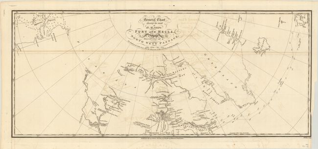
Title:
“General Chart Shewing the Track of H.M. Ships Fury and Hecla, on a Voyage for the Discovery of a North West Passage, AD. 1821-22-23”
Map Maker:
Admiral Sir William Edward Parry
This detailed chart delineates Admiral Parry's voy... (full text available to subscribers)
| Item Detail |
| |
| |
MapMaker: |
Admiral Sir William Edward Parry
|
|
| |
| |
Subject: |
Canada |
|
| |
Period/Size: |
1824 / 10.1" x 23.8" (25.7 x 60.5 cm)
|
|
| |
Color: |
Black & White
|
|
| |
Condition: |
(B) Issued folding with offsetting. (condition help) |
|
| |
Source: |
Journal of a Second Voyage |
|
| |
References: |
|
|
| |
|
|
| Sales Information |
| |
| |
Price: |
|
|
| |
| |
Offered by: |
Old World Auctions |
|
| |
Catalog: |
Auction No. 184 - Antique Maps, Charts, Atlases & Globes (9549) |
|
| |
Lot/Item #: |
125 |
|
| |
| |
Date: |
09/2021
|
|
| |
| |
|
Antique Maps - Valuation and Pricing, Descriptions, Resources |
|
Home |
Information |
Search |
Register |
Contact Us |
Site Map
Americana Exchange, Inc. © 1999 - 2024 Americana Exchange, Inc.. All rights reserved.
OldMaps.com, the OldMaps.com logo and
AMPR are service marks or registered service marks of Americana Exchange, Inc..
|