| Item Detail |
| |
| |
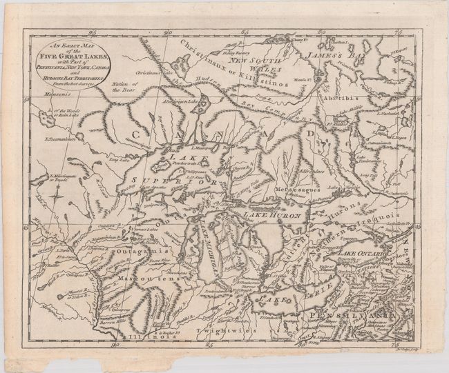
MapMaker: |
John Lodge
|
|
| |
| |
Subject: |
Colonial Central United States & Canada, Great Lakes |
|
| |
Period/Size: |
1778 / 8.1" x 10.1" (20.6 x 25.7 cm)
|
|
| |
Color: |
Black & White
|
|
| |
Condition: |
(A) A nice impression, issued folding on a bright, watermarked sheet with faint toning and some chips in the bottom blank margin where the map was removed from the book. (condition help) |
|
| |
Source: |
The History of America |
|
| |
References: |
Kershaw #983; Phillips (Maps) p. 859. |
|
| |
|
|
| Sales Information |
| |
| |
Price: |
|
|
| |
| |
Offered by: |
Old World Auctions |
|
| |
Catalog: |
Auction No. 184 - Antique Maps, Charts, Atlases & Globes (9549) |
|
| |
Lot/Item #: |
152 |
|
| |
| |
Date: |
09/2021
|
|
| |
| |
|