Title:
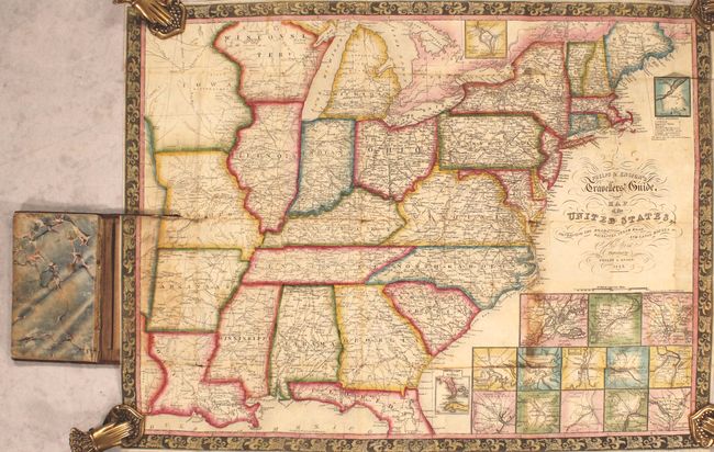
“Phelps & Ensign's Travellers' Guide, and Map of the United States, Containing the Roads, Distances, Steam Boat and Canal Routes &c.”
Map Maker:
Phelps & Ensign
This is the 1842 edition of Phelps & Ensign's Trav... (full text available to subscribers)
| Item Detail |
| |
| |
MapMaker: |
Phelps & Ensign
|
|
| |
| |
Subject: |
Eastern United States |
|
| |
Period/Size: |
1842 / 16.8" x 22.8" (42.7 x 58.0 cm)
|
|
| |
Color: |
Colored
|
|
| |
Condition: |
(B) Issued folding with full contemporary color and scattered foxing. There are numerous fold separations, minute loss at a couple of fold junctions, a 1" tear in central Tennessee, and a couple of tiny tears in Missouri. Covers are worn and stained. (condition help) |
|
| |
Source: |
|
|
| |
References: |
Howes #P-291. |
|
| |
|
|
| Sales Information |
| |
| |
Price: |
|
|
| |
| |
Offered by: |
Old World Auctions |
|
| |
Catalog: |
Auction No. 184 - Antique Maps, Charts, Atlases & Globes (9549) |
|
| |
Lot/Item #: |
187 |
|
| |
| |
Date: |
09/2021
|
|
| |
| |
|
Antique Maps - Valuation and Pricing, Descriptions, Resources |
|
Home |
Information |
Search |
Register |
Contact Us |
Site Map
Americana Exchange, Inc. © 1999 - 2024 Americana Exchange, Inc.. All rights reserved.
OldMaps.com, the OldMaps.com logo and
AMPR are service marks or registered service marks of Americana Exchange, Inc..
|