| Item Detail |
| |
| |
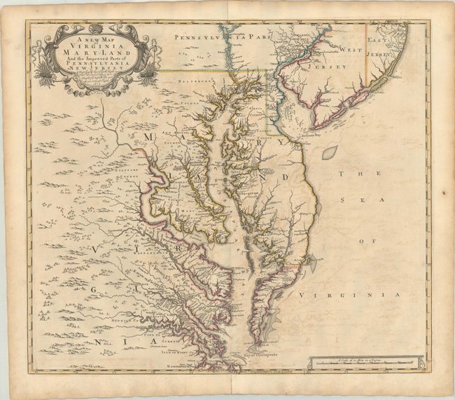
MapMaker: |
Browne/Senex
|
|
| |
| |
Subject: |
Colonial Mid-Atlantic United States |
|
| |
Period/Size: |
1719 / 19.2" x 22.0" (48.8 x 55.9 cm)
|
|
| |
Color: |
Colored
|
|
| |
Condition: |
(B) A dark impression with contemporary outline color on a sheet with a fleur-de-lis watermark, moderate offsetting, and a centerfold separation that enters 1" into image at bottom and has been closed on verso with old paper. There is light toning along (condition help) |
|
| |
Source: |
New General Atlas |
|
| |
References: |
Burden #694; Stephenson & McKee, p. 52, #II-17; Stevens & Tree #86c; Wooldridge #84. |
|
| |
|
|
| Sales Information |
| |
| |
Price: |
|
|
| |
| |
Offered by: |
Old World Auctions |
|
| |
Catalog: |
Auction No. 184 - Antique Maps, Charts, Atlases & Globes (9549) |
|
| |
Lot/Item #: |
199 |
|
| |
| |
Date: |
09/2021
|
|
| |
| |
|