| Item Detail |
| |
| |
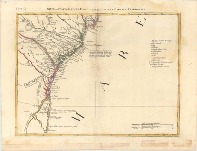
MapMaker: |
Antonio Zatta
|
|
| |
| |
Subject: |
Southeast United States |
|
| |
Period/Size: |
1785 / 12.6" x 16.8" (32.0 x 42.7 cm)
|
|
| |
Color: |
Colored
|
|
| |
Condition: |
(B) Original color on paper with the watermark of three crescent moons with "Mezzana." There are stains along the centerfold at top and at right, along with professional repairs to a tear adjacent to the centerfold. The bottom margin had been cut off an (condition help) |
|
| |
Source: |
Atlante Novissimo |
|
| |
References: |
Portinaro & Knirsch #153; Sellers and Van Ee #163; Shirley (BL Atlases) T.ZAT-1, Vol 4 #38. |
|
| |
|
|
| Sales Information |
| |
| |
Price: |
|
|
| |
| |
Offered by: |
Old World Auctions |
|
| |
Catalog: |
Auction No. 184 - Antique Maps, Charts, Atlases & Globes (9549) |
|
| |
Lot/Item #: |
211 |
|
| |
| |
Date: |
09/2021
|
|
| |
| |
|