| Item Detail |
| |
| |
MapMaker: |
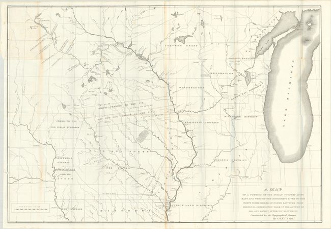
U.S. Gov.
|
|
| |
| |
Subject: |
Upper Midwestern United States |
|
| |
Period/Size: |
1836 / 26.3" x 38.0" (66.8 x 96.6 cm)
|
|
| |
Color: |
Black & White
|
|
| |
Condition: |
(B+) On a bright sheet with a bit of foxing, light toning along a few folds, and a 3.5" edge tear at top left that has been closed on verso with archival tape. (condition help) |
|
| |
Source: |
Report of a Geological Reconnoissance Made in 1835... |
|
| |
References: |
Claussen & Friis #94. |
|
| |
|
|
| Sales Information |
| |
| |
Price: |
|
|
| |
| |
Offered by: |
Old World Auctions |
|
| |
Catalog: |
Auction No. 184 - Antique Maps, Charts, Atlases & Globes (9549) |
|
| |
Lot/Item #: |
230 |
|
| |
| |
Date: |
09/2021
|
|
| |
| |
|