| Item Detail |
| |
| |
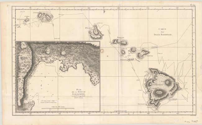
MapMaker: |
Cook/Benard
|
|
| |
| |
Subject: |
Hawaii |
|
| |
Period/Size: |
1785 / 10.9" x 18.2" (27.7 x 46.3 cm)
|
|
| |
Color: |
Black & White
|
|
| |
Condition: |
(B+) Issued folding and now flat with a small hole in an unengraved area at center that has been professionally repaired on verso. There is some minor offsetting and a repaired edge chip in the right blank margin. (condition help) |
|
| |
Source: |
Troisieme Voyage de Cook, ou Voyage a l'Ocean Pacifique… |
|
| |
References: |
Shirley (BL Atlases) G.COOK-4a #16; cf. Fitzpatrick, pp. 15-18, plt. 2. |
|
| |
|
|
| Sales Information |
| |
| |
Price: |
|
|
| |
| |
Offered by: |
Old World Auctions |
|
| |
Catalog: |
Auction No. 184 - Antique Maps, Charts, Atlases & Globes (9549) |
|
| |
Lot/Item #: |
290 |
|
| |
| |
Date: |
09/2021
|
|
| |
| |
|