|
|
||
Title:
“Mouth of Chester River (Harbor of Refuge No. ) from a Trigonometrical Survey Under the Direction of A.D. Bache Superintendent of the Survey of the Coast of the United States...”
Map Maker:
U.S. Coast Survey
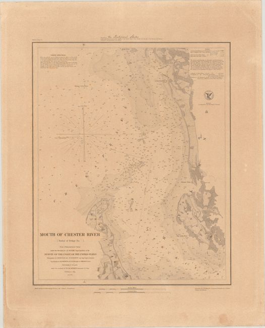
This detailed chart focuses on the wide mouth of t... (full text available to subscribers)
|
|
|||||||||||||||||||||||||||||||||||||||||||||||||||||||||||||||||||||||||||||||||||||||||
Antique Maps - Valuation and Pricing, Descriptions, Resources | ||||||||||||||||||||||||||||||||||||||||||||||||||||||||||||||||||||||||||||||||||||||||||
|
Home |
Information |
Search |
Register |
Contact Us |
Site Map
Americana Exchange, Inc. © 1999 - 2024 Americana Exchange, Inc.. All rights reserved.
OldMaps.com, the OldMaps.com logo and |