| Item Detail |
| |
| |
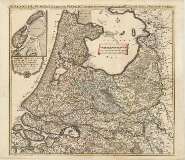
MapMaker: |
Caspar Specht
|
|
| |
| |
Subject: |
Netherlands |
|
| |
Period/Size: |
1704 / 20.3" x 22.8" (51.6 x 58.0 cm)
|
|
| |
Color: |
Colored
|
|
| |
Condition: |
(A) A sharp impression on a bright sheet, issued folding and now flattened with professional repairs to a 1.5" tear just below the distance scale and a couple of edge tears in the right blank margin. (condition help) |
|
| |
Source: |
|
|
| |
References: |
|
|
| |
|
|
| Sales Information |
| |
| |
Price: |
|
|
| |
| |
Offered by: |
Old World Auctions |
|
| |
Catalog: |
Auction No. 184 - Antique Maps, Charts, Atlases & Globes (9549) |
|
| |
Lot/Item #: |
477 |
|
| |
| |
Date: |
09/2021
|
|
| |
| |
|