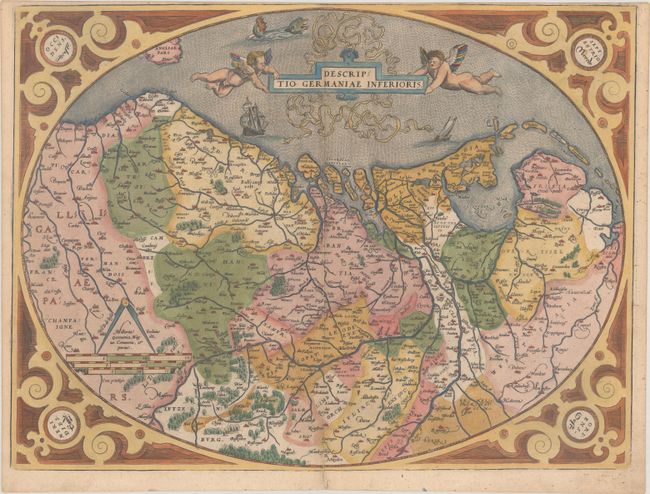
Title:
“Descriptio Germaniae Inferioris”
Map Maker:
Abraham Ortelius
This highly decorative map of The Netherlands, Bel... (full text available to subscribers)
| Item Detail |
| |
| |
MapMaker: |
Abraham Ortelius
|
|
| |
| |
Subject: |
Low Countries |
|
| |
Period/Size: |
1575 / 14.9" x 19.8" (37.9 x 50.3 cm)
|
|
| |
Color: |
Colored
|
|
| |
Condition: |
(B+) A nice impression on a sturdy sheet with the crossed arrows watermark commonly found on Ortelius maps. There is minor soiling and an archivally repaired centerfold separation that enters 1.5" into image at bottom. Trimmed to neatline at top by book (condition help) |
|
| |
Source: |
Theatrum Orbis Terrarum |
|
| |
References: |
Van den Broecke #58. |
|
| |
|
|
| Sales Information |
| |
| |
Price: |
|
|
| |
| |
Offered by: |
Old World Auctions |
|
| |
Catalog: |
Auction No. 184 - Antique Maps, Charts, Atlases & Globes (9549) |
|
| |
Lot/Item #: |
482 |
|
| |
| |
Date: |
09/2021
|
|
| |
| |
|
Antique Maps - Valuation and Pricing, Descriptions, Resources |
|
Home |
Information |
Search |
Register |
Contact Us |
Site Map
Americana Exchange, Inc. © 1999 - 2024 Americana Exchange, Inc.. All rights reserved.
OldMaps.com, the OldMaps.com logo and
AMPR are service marks or registered service marks of Americana Exchange, Inc..
|