Title:
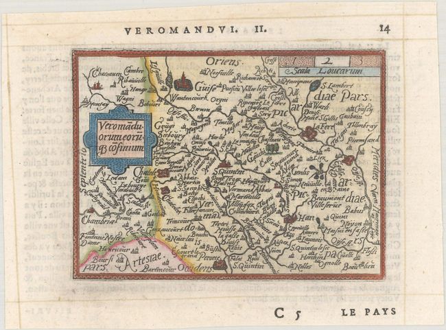
“Veromaduorum Eoruq Cofinium”
Map Maker:
Ortelius/Galle
This delightful miniature map of the Picardy regio... (full text available to subscribers)
| Item Detail |
| |
| |
MapMaker: |
Ortelius/Galle
|
|
| |
| |
Subject: |
Northern France |
|
| |
Period/Size: |
1579 / 3.1" x 4.2" (7.9 x 10.7 cm)
|
|
| |
Color: |
Colored
|
|
| |
Condition: |
(A) A sharp impression on a bright sheet with two tiny holes near the cartouche that have been professionally repaired. (condition help) |
|
| |
Source: |
Le Miroir du Monde |
|
| |
References: |
King (2nd Ed.) pp. 60-61; Van der Krogt (Vol. III) #4160:331. |
|
| |
|
|
| Sales Information |
| |
| |
Price: |
|
|
| |
| |
Offered by: |
Old World Auctions |
|
| |
Catalog: |
Auction No. 184 - Antique Maps, Charts, Atlases & Globes (9549) |
|
| |
Lot/Item #: |
488 |
|
| |
| |
Date: |
09/2021
|
|
| |
| |
|
Antique Maps - Valuation and Pricing, Descriptions, Resources |
|
Home |
Information |
Search |
Register |
Contact Us |
Site Map
Americana Exchange, Inc. © 1999 - 2024 Americana Exchange, Inc.. All rights reserved.
OldMaps.com, the OldMaps.com logo and
AMPR are service marks or registered service marks of Americana Exchange, Inc..
|