| Item Detail |
| |
| |
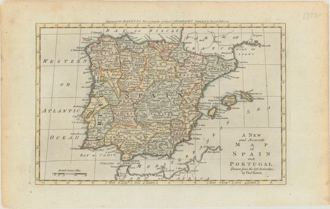
MapMaker: |
Thomas Bowen
|
|
| |
| |
Subject: |
Spain & Portugal |
|
| |
Period/Size: |
1787 / 7.4" x 11.5" (18.8 x 29.3 cm)
|
|
| |
Color: |
Colored
|
|
| |
Condition: |
(A) There is some minor toning along the sheet's edges. (condition help) |
|
| |
Source: |
Bankes's New & Complete System of Geography |
|
| |
References: |
McCorkle (18th C. Geography Books) #11 [19]; Shirley (BL Atlases) T.BANK-1a #19. |
|
| |
|
|
| Sales Information |
| |
| |
Price: |
|
|
| |
| |
Offered by: |
Old World Auctions |
|
| |
Catalog: |
Auction No. 184 - Antique Maps, Charts, Atlases & Globes (9549) |
|
| |
Lot/Item #: |
500 |
|
| |
| |
Date: |
09/2021
|
|
| |
| |
|