Title:
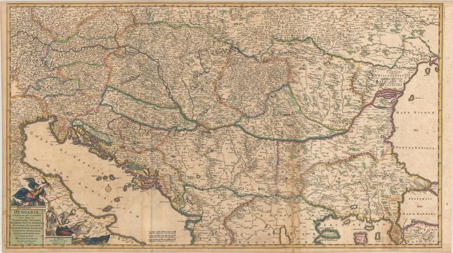
“Regni Hungariae, et Regionum, quae ei Quondam Fuere Unitae, ut Transilvaniae, Valachiae, Moldaviae, Serviae, Romaniae, Bulgariae, Bessarabiae, Croatiae, Bosniae, Dalmatiae, Sclavoniae, Morlachiae, Ragusanae Reipublciae...”
Map Maker:
Frederick de Wit
This large-scale map shows the Kingdom of Hungary ... (full text available to subscribers)
| Item Detail |
| |
| |
MapMaker: |
Frederick de Wit
|
|
| |
| |
Subject: |
Southeastern Europe, Hungary |
|
| |
Period/Size: |
1688 / 19.6" x 34.9" (49.8 x 88.7 cm)
|
|
| |
Color: |
Colored
|
|
| |
Condition: |
(B) Contemporary color with light toning and scattered foxing, issued folding. Fold separations that extend 3", 9" and 11" (from right fold to left fold) have been repaired on verso with old paper. (condition help) |
|
| |
Source: |
|
|
| |
References: |
|
|
| |
|
|
| Sales Information |
| |
| |
Price: |
|
|
| |
| |
Offered by: |
Old World Auctions |
|
| |
Catalog: |
Auction No. 184 - Antique Maps, Charts, Atlases & Globes (9549) |
|
| |
Lot/Item #: |
553 |
|
| |
| |
Date: |
09/2021
|
|
| |
| |
|
Antique Maps - Valuation and Pricing, Descriptions, Resources |
|
Home |
Information |
Search |
Register |
Contact Us |
Site Map
Americana Exchange, Inc. © 1999 - 2024 Americana Exchange, Inc.. All rights reserved.
OldMaps.com, the OldMaps.com logo and
AMPR are service marks or registered service marks of Americana Exchange, Inc..
|