| Item Detail |
| |
| |
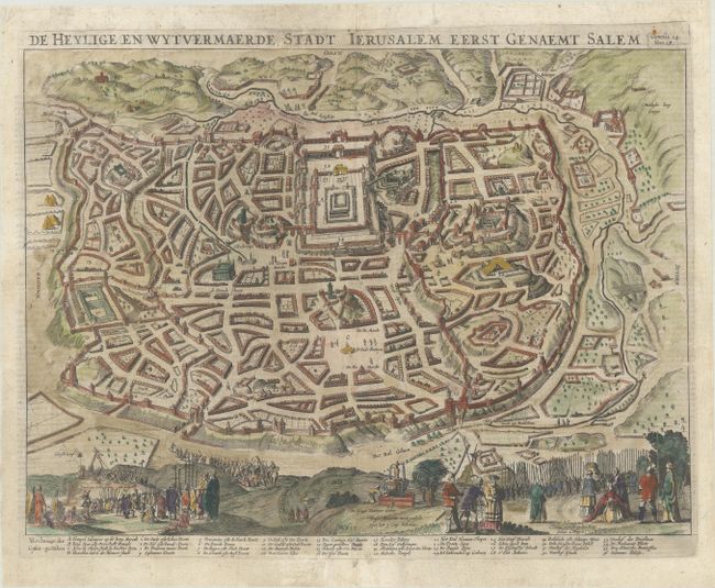
MapMaker: |
Cornelius Danckerts
|
|
| |
| |
Subject: |
Jerusalem, Holy Land |
|
| |
Period/Size: |
1646 / 12.3" x 16.8" (31.3 x 42.7 cm)
|
|
| |
Color: |
Colored
|
|
| |
Condition: |
(A) A nice impression on a bright sheet with some printer's ink residue. There are professional repairs to some minor separations along the centerfold and to two short edge tears. (condition help) |
|
| |
Source: |
|
|
| |
References: |
Poortman & Augusteijn #104. |
|
| |
|
|
| Sales Information |
| |
| |
Price: |
|
|
| |
| |
Offered by: |
Old World Auctions |
|
| |
Catalog: |
Auction No. 184 - Antique Maps, Charts, Atlases & Globes (9549) |
|
| |
Lot/Item #: |
638 |
|
| |
| |
Date: |
09/2021
|
|
| |
| |
|