|
|
||
Title:
“Chart Showing the Track of the Flagships of the U.S. Japan Expedition to the Eastd. of the Cape of Good Hope 1853 & 1854”
Map Maker:
Ackerman
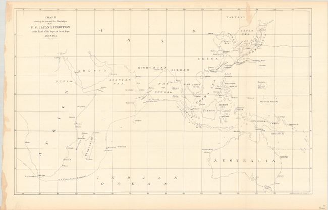
This chart tracks the course of Commodore Matthew ... (full text available to subscribers)
|
|
|||||||||||||||||||||||||||||||||||||||||||||||||||||||||||||||||||||||||||||||||||||||||
Antique Maps - Valuation and Pricing, Descriptions, Resources | ||||||||||||||||||||||||||||||||||||||||||||||||||||||||||||||||||||||||||||||||||||||||||
|
Home |
Information |
Search |
Register |
Contact Us |
Site Map
Americana Exchange, Inc. © 1999 - 2024 Americana Exchange, Inc.. All rights reserved.
OldMaps.com, the OldMaps.com logo and |