| Item Detail |
| |
| |
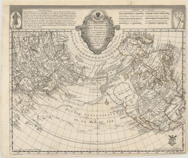
MapMaker: |
Leonhard Euler
|
|
| |
| |
Subject: |
North Pacific, Northern Asia & North America |
|
| |
Period/Size: |
1760 / 12.7" x 15.0" (32.3 x 38.1 cm)
|
|
| |
Color: |
Colored
|
|
| |
Condition: |
(B+) A sharp impression on a bright sheet with an "R" watermark. There is a spot of foxing adjacent to the title cartouche, minor soiling, and faint show-through of a previous owner's stamp on verso. A few short edge tears and a chip at bottom right hav (condition help) |
|
| |
Source: |
Atlas Geographicus |
|
| |
References: |
McGuirk #26; Kershaw #1203; Phillips (A) #625-44. |
|
| |
|
|
| Sales Information |
| |
| |
Price: |
|
|
| |
| |
Offered by: |
Old World Auctions |
|
| |
Catalog: |
Auction No. 184 - Antique Maps, Charts, Atlases & Globes (9549) |
|
| |
Lot/Item #: |
731 |
|
| |
| |
Date: |
09/2021
|
|
| |
| |
|