Rister or Sign In to see pricing information


Title:

The National Savings Picture Map of the Continent of Europe with Its Geography and Natural Features Clearly Portrayed...

The National Savings Picture Map of the Continent of Europe with Its Geography and Natural Features Clearly Portrayed...

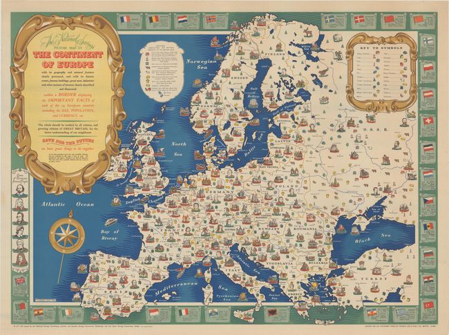
This colorful pictorial map was created by H. Char... (full text available to subscribers)
Item Detail
 
  MapMaker:  

(none given)


  Subject:  Europe  
  Period/Size:  1945 / 27.9" x 37.9"  (70.9 x 96.3 cm)  
  Color:  Colored  
  Condition:  (A) A clean and bright example with just a hint of soiling and minor creasing along the edges of the sheet. (condition help)  
  Source:   
  References:   
 
 
Sales Information
 
  Price: 

Please register your email to view records, or sign in with email address to see records


  Offered by:  Old World Auctions  
  Catalog:  Auction No. 185 - Antique Maps, Charts, Atlases & Globes (9550)  
  Lot/Item #:  436  
 
  Date:  11/2021  


Antique Maps - Valuation and Pricing, Descriptions, Resources


Home | Information | Search | Register | Contact Us | Site Map

Americana Exchange, Inc. © 1999 - 2024 Americana Exchange, Inc.. All rights reserved. OldMaps.com, the OldMaps.com logo and
AMPR are service marks or registered service marks of Americana Exchange, Inc..