| Item Detail |
| |
| |
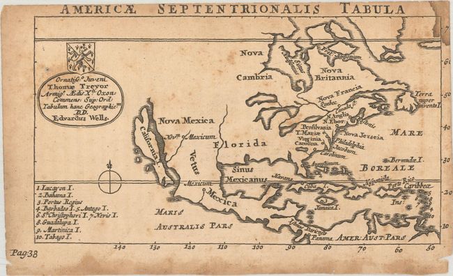
MapMaker: |
Edward Wells
|
|
| |
| |
Subject: |
Colonial North America |
|
| |
Period/Size: |
1726 / 3.4" x 6.2" (8.7 x 15.8 cm)
|
|
| |
Color: |
Black & White
|
|
| |
Condition: |
(B) There is light toning, scattered foxing, and dampstains in the top right corner and bottom blank margin. (condition help) |
|
| |
Source: |
Geographia Emendata & Locupletata |
|
| |
References: |
McLaughlin #205. |
|
| |
|
|
| Sales Information |
| |
| |
Price: |
|
|
| |
| |
Offered by: |
Old World Auctions |
|
| |
Catalog: |
Auction No. 185 - Antique Maps, Charts, Atlases & Globes (9550) |
|
| |
Lot/Item #: |
90 |
|
| |
| |
Date: |
11/2021
|
|
| |
| |
|