| Item Detail |
| |
| |
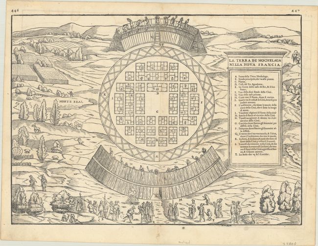
MapMaker: |
Gastaldi/Ramusio
|
|
| |
| |
Subject: |
Montreal, Canada |
|
| |
Period/Size: |
1556 / 10.6" x 14.6" (27.0 x 37.1 cm)
|
|
| |
Color: |
Black & White
|
|
| |
Condition: |
(B+) A crisp impression on a sheet with an anchor watermark. There is faint dampstaining that enters the engraved image at top, minor offsetting, and some faint soiling. (condition help) |
|
| |
Source: |
Terzo Volume delle Navigationi et Viaggi |
|
| |
References: |
Goss #7; Kershaw #17a; Mickwitz & Miekkavaara #641 Vol. III #8; Schwartz & Ehrenberg, plt. 28; Shirley (BL Atlases) G.RAMU-2a #9. |
|
| |
|
|
| Sales Information |
| |
| |
Price: |
|
|
| |
| |
Offered by: |
Old World Auctions |
|
| |
Catalog: |
Auction No. 185 - Antique Maps, Charts, Atlases & Globes (9550) |
|
| |
Lot/Item #: |
121 |
|
| |
| |
Date: |
11/2021
|
|
| |
| |
|