| Item Detail |
| |
| |
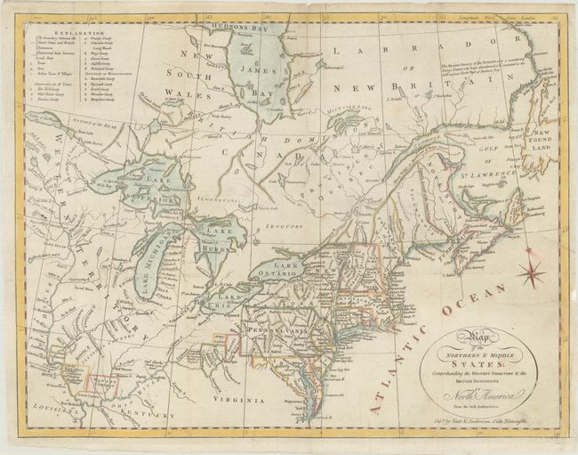
MapMaker: |
Amos Doolittle
|
|
| |
| |
Subject: |
Northeastern United States & Canada |
|
| |
Period/Size: |
1800 / 11.6" x 15.1" (29.5 x 38.4 cm)
|
|
| |
Color: |
Colored
|
|
| |
Condition: |
(B+) Issued folding, now flat, with archival repairs to a small binding tear at right and a short split along a fold at top. Minor soiling. (condition help) |
|
| |
Source: |
A Concise System of Modern Geography... |
|
| |
References: |
McCorkle #800.1; McCorkle (18th C. Geography Books) #438-5 (Vol. II). |
|
| |
|
|
| Sales Information |
| |
| |
Price: |
|
|
| |
| |
Offered by: |
Old World Auctions |
|
| |
Catalog: |
Auction No. 185 - Antique Maps, Charts, Atlases & Globes (9550) |
|
| |
Lot/Item #: |
137 |
|
| |
| |
Date: |
11/2021
|
|
| |
| |
|