| Item Detail |
| |
| |
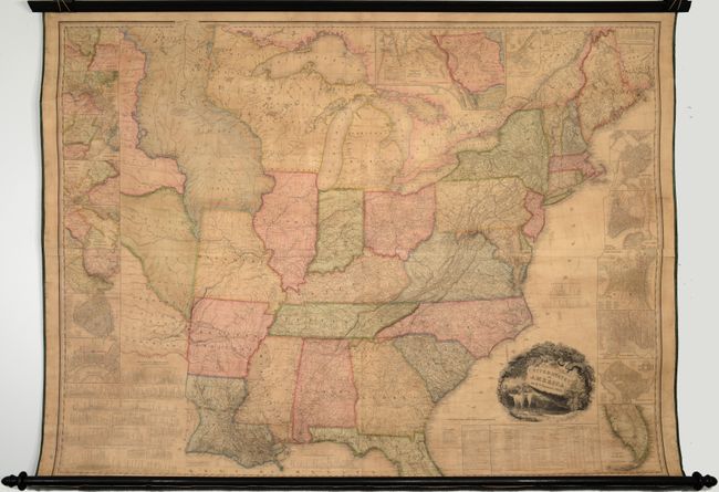
MapMaker: |
H.S. Tanner
|
|
| |
| |
Subject: |
United States |
|
| |
Period/Size: |
1829 / 45.4" x 59.8" (115.4 x 151.9 cm)
|
|
| |
Color: |
Colored
|
|
| |
Condition: |
(B+) Professionally backed on heavy linen with original rollers present and intact. There is even light toning, occasional staining, and a number of small edge cracks mostly at top and bottom, as well as one at top left that extends 2" into the image. A (condition help) |
|
| |
Source: |
|
|
| |
References: |
Phillips (Maps) p. 885; Howes #T-28; Ristow pp. 198-199; Streeter #3835; Sabin #94318; Schwartz & Ehrenberg p. 253. |
|
| |
|
|
| Sales Information |
| |
| |
Price: |
|
|
| |
| |
Offered by: |
Old World Auctions |
|
| |
Catalog: |
Auction No. 185 - Antique Maps, Charts, Atlases & Globes (9550) |
|
| |
Lot/Item #: |
155 |
|
| |
| |
Date: |
11/2021
|
|
| |
| |
|