| Item Detail |
| |
| |
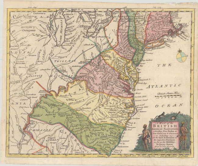
MapMaker: |
Emanuel Bowen
|
|
| |
| |
Subject: |
Colonial Eastern United States |
|
| |
Period/Size: |
1754 / 8.6" x 10.7" (21.9 x 27.2 cm)
|
|
| |
Color: |
Colored
|
|
| |
Condition: |
(A) A nice impression on a bright sheet, issued folding, now pressed. A binding trim at bottom left has been professionally replaced with old paper and a small chip at right has also been professionally repaired. (condition help) |
|
| |
Source: |
Gentleman's Magazine |
|
| |
References: |
Jolly #GENT-89; McCorkle #754-1; Sellers & Van Ee #708; cf. Cumming (SE) #272. |
|
| |
|
|
| Sales Information |
| |
| |
Price: |
|
|
| |
| |
Offered by: |
Old World Auctions |
|
| |
Catalog: |
Auction No. 185 - Antique Maps, Charts, Atlases & Globes (9550) |
|
| |
Lot/Item #: |
173 |
|
| |
| |
Date: |
11/2021
|
|
| |
| |
|