Title:
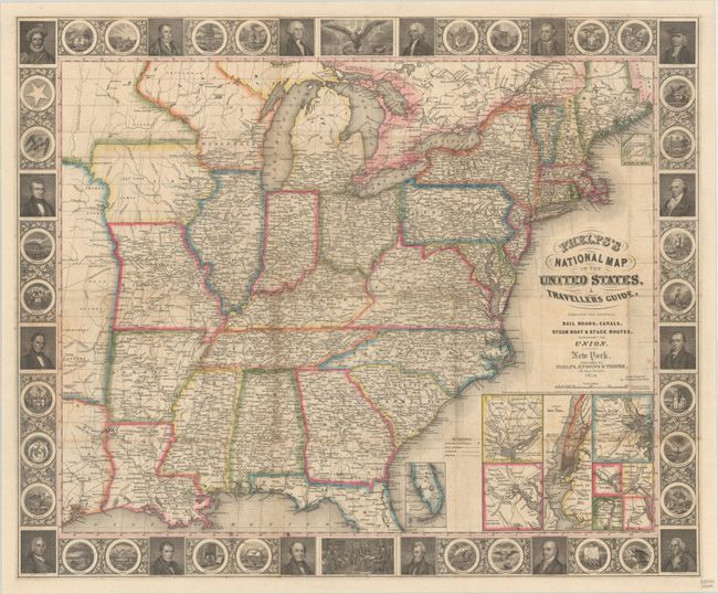
“Phelps's National Map of the United States, A Travellers Guide. Embracing the Principal Rail Roads, Canals, Steam Boat & Stage Routes, Throughout the Union”
This completely re-engraved, first edition folding... (full text available to subscribers)
| Item Detail |
| |
| |
MapMaker: |
(none given)
|
|
| |
| |
Subject: |
Eastern United States |
|
| |
Period/Size: |
1847 / 21.0" x 25.5" (53.4 x 64.8 cm)
|
|
| |
Color: |
Colored
|
|
| |
Condition: |
(B+) Issued folding and now flattened and backed with heavy linen. There is some light toning along a few folds and minor foxing. (condition help) |
|
| |
Source: |
|
|
| |
References: |
Howes #P-291; Rumsey #0719.003. |
|
| |
|
|
| Sales Information |
| |
| |
Price: |
|
|
| |
| |
Offered by: |
Old World Auctions |
|
| |
Catalog: |
Auction No. 185 - Antique Maps, Charts, Atlases & Globes (9550) |
|
| |
Lot/Item #: |
191 |
|
| |
| |
Date: |
11/2021
|
|
| |
| |
|
Antique Maps - Valuation and Pricing, Descriptions, Resources |
|
Home |
Information |
Search |
Register |
Contact Us |
Site Map
Americana Exchange, Inc. © 1999 - 2024 Americana Exchange, Inc.. All rights reserved.
OldMaps.com, the OldMaps.com logo and
AMPR are service marks or registered service marks of Americana Exchange, Inc..
|