Title:
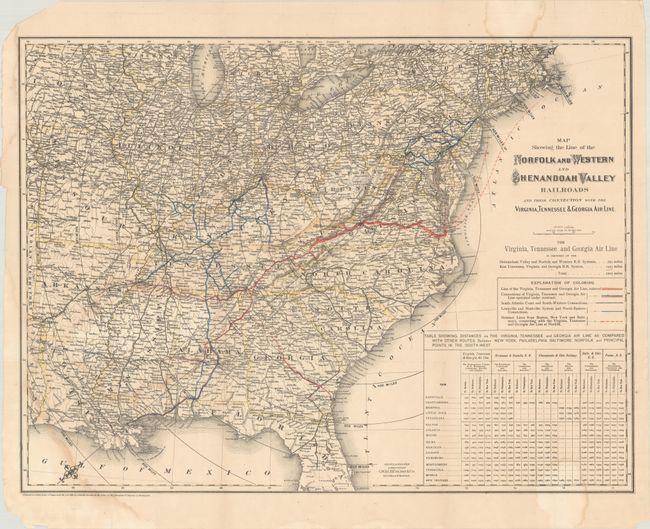
“Map Showing the Line of the Norfolk and Western and Shenandoah Valley Railroads and Their Connection with the Virginia, Tennessee & Georgia Air Line”
Map Maker:
G. W. & C.B. Colton
This detailed map of the eastern United States sho... (full text available to subscribers)
| Item Detail |
| |
| |
MapMaker: |
G. W. & C.B. Colton
|
|
| |
| |
Subject: |
Eastern United States |
|
| |
Period/Size: |
1881 / 19.1" x 25.6" (48.6 x 65.1 cm)
|
|
| |
Color: |
Colored
|
|
| |
Condition: |
(B+) Issued folding with a number of small fold separations along the sheet edges that have been closed on verso with archival tape. There are light dampstains primarily at lower left and top right. (condition help) |
|
| |
Source: |
|
|
| |
References: |
|
|
| |
|
|
| Sales Information |
| |
| |
Price: |
|
|
| |
| |
Offered by: |
Old World Auctions |
|
| |
Catalog: |
Auction No. 185 - Antique Maps, Charts, Atlases & Globes (9550) |
|
| |
Lot/Item #: |
194 |
|
| |
| |
Date: |
11/2021
|
|
| |
| |
|
Antique Maps - Valuation and Pricing, Descriptions, Resources |
|
Home |
Information |
Search |
Register |
Contact Us |
Site Map
Americana Exchange, Inc. © 1999 - 2024 Americana Exchange, Inc.. All rights reserved.
OldMaps.com, the OldMaps.com logo and
AMPR are service marks or registered service marks of Americana Exchange, Inc..
|