| Item Detail |
| |
| |
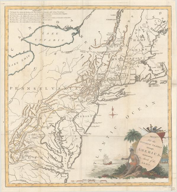
MapMaker: |
Thomas Conder
|
|
| |
| |
Subject: |
New England & Mid-Atlantic United States |
|
| |
Period/Size: |
1789 / 15.5" x 14.4" (39.4 x 36.6 cm)
|
|
| |
Color: |
Colored
|
|
| |
Condition: |
(B) Issued folding with 3" and 6" edge tears at right that have been closed on verso with old paper. A 4" fold separation at top left has also been archivally repaired on verso, and a binding trim at right has been replaced with old paper. (condition help) |
|
| |
Source: |
Travels Through the Interior Parts of America |
|
| |
References: |
McCorkle #789.5. |
|
| |
|
|
| Sales Information |
| |
| |
Price: |
|
|
| |
| |
Offered by: |
Old World Auctions |
|
| |
Catalog: |
Auction No. 185 - Antique Maps, Charts, Atlases & Globes (9550) |
|
| |
Lot/Item #: |
197 |
|
| |
| |
Date: |
11/2021
|
|
| |
| |
|