Title:
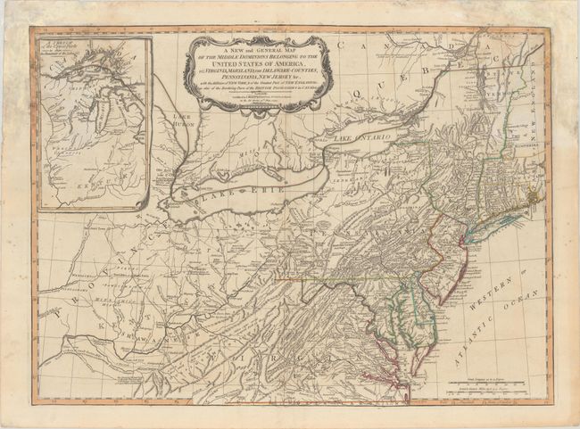
“A New and General Map of the Middle Dominions Belonging to the United States of America, viz. Virginia, Maryland, the Delaware-Counties, Pennsylvania, New Jersey &c...”
Map Maker:
Laurie & Whittle
This is probably one of the most popular contempor... (full text available to subscribers)
| Item Detail |
| |
| |
MapMaker: |
Laurie & Whittle
|
|
| |
| |
Subject: |
Mid-Atlantic United States |
|
| |
Period/Size: |
1794 / 19.1" x 26.3" (48.6 x 66.8 cm)
|
|
| |
Color: |
Colored
|
|
| |
Condition: |
(B) Contemporary outline color with dampstaining in the top corners of the sheet that has been backed with old paper on verso for reinforcement. (condition help) |
|
| |
Source: |
|
|
| |
References: |
McCorkle #794.6; Tooley (Amer) p. 68, #30h; Stephenson & McKee, p. 53-54. |
|
| |
|
|
| Sales Information |
| |
| |
Price: |
|
|
| |
| |
Offered by: |
Old World Auctions |
|
| |
Catalog: |
Auction No. 185 - Antique Maps, Charts, Atlases & Globes (9550) |
|
| |
Lot/Item #: |
207 |
|
| |
| |
Date: |
11/2021
|
|
| |
| |
|
Antique Maps - Valuation and Pricing, Descriptions, Resources |
|
Home |
Information |
Search |
Register |
Contact Us |
Site Map
Americana Exchange, Inc. © 1999 - 2024 Americana Exchange, Inc.. All rights reserved.
OldMaps.com, the OldMaps.com logo and
AMPR are service marks or registered service marks of Americana Exchange, Inc..
|