Title:
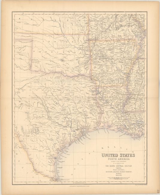
“United States North America ... The South Central Section Comprising Texas, Louisiana, Mississippi, Arkansas, Western Territory, and Part of Missouri”
Map Maker:
Swanston/Fullerton
This very finely engraved map is beautifully rende... (full text available to subscribers)
| Item Detail |
| |
| |
MapMaker: |
Swanston/Fullerton
|
|
| |
| |
Subject: |
South Central United States |
|
| |
Period/Size: |
1860 / 20.2" x 15.8" (51.3 x 40.2 cm)
|
|
| |
Color: |
Colored
|
|
| |
Condition: |
(A) There is light toning in the margins. (condition help) |
|
| |
Source: |
Royal Illustrated Atlas of Modern Geography |
|
| |
References: |
|
|
| |
|
|
| Sales Information |
| |
| |
Price: |
|
|
| |
| |
Offered by: |
Old World Auctions |
|
| |
Catalog: |
Auction No. 185 - Antique Maps, Charts, Atlases & Globes (9550) |
|
| |
Lot/Item #: |
223 |
|
| |
| |
Date: |
11/2021
|
|
| |
| |
|
Antique Maps - Valuation and Pricing, Descriptions, Resources |
|
Home |
Information |
Search |
Register |
Contact Us |
Site Map
Americana Exchange, Inc. © 1999 - 2024 Americana Exchange, Inc.. All rights reserved.
OldMaps.com, the OldMaps.com logo and
AMPR are service marks or registered service marks of Americana Exchange, Inc..
|