Title:
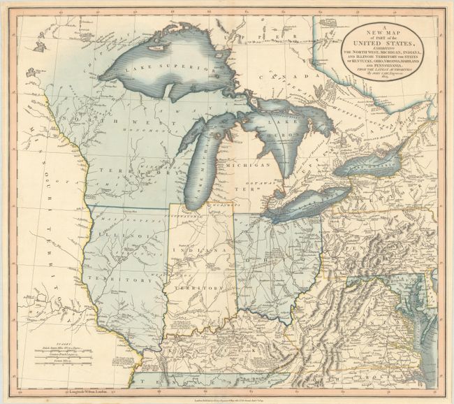
“A New Map of Part of the United States, Exhibiting the North West, Michigan, Indiana, and Illinois Territory the States of Kentucky, Ohio, Virginia, Maryland and Pennsylvania. From the Latest Authorities”
Map Maker:
John Cary
Great map of the early mid-western territories sho... (full text available to subscribers)
| Item Detail |
| |
| |
MapMaker: |
John Cary
|
|
| |
| |
Subject: |
Central & Mid-Atlantic United States |
|
| |
Period/Size: |
1825 / 18.0" x 20.2" (45.8 x 51.3 cm)
|
|
| |
Color: |
Colored
|
|
| |
Condition: |
(A) Full contemporary color on a clean, bright sheet with a few faint spots of foxing. (condition help) |
|
| |
Source: |
|
|
| |
References: |
|
|
| |
|
|
| Sales Information |
| |
| |
Price: |
|
|
| |
| |
Offered by: |
Old World Auctions |
|
| |
Catalog: |
Auction No. 185 - Antique Maps, Charts, Atlases & Globes (9550) |
|
| |
Lot/Item #: |
225 |
|
| |
| |
Date: |
11/2021
|
|
| |
| |
|
Antique Maps - Valuation and Pricing, Descriptions, Resources |
|
Home |
Information |
Search |
Register |
Contact Us |
Site Map
Americana Exchange, Inc. © 1999 - 2024 Americana Exchange, Inc.. All rights reserved.
OldMaps.com, the OldMaps.com logo and
AMPR are service marks or registered service marks of Americana Exchange, Inc..
|