| Item Detail |
| |
| |
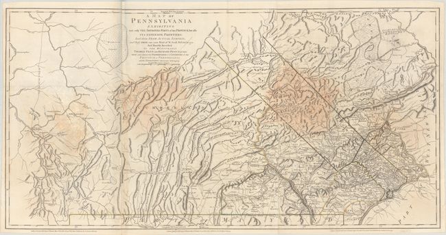
MapMaker: |
Robert Sayer & John Bennett
|
|
| |
| |
Subject: |
Pennsylvania, Revolutionary War |
|
| |
Period/Size: |
1775 / 26.9" x 53.0" (68.4 x 134.7 cm)
|
|
| |
Color: |
Colored
|
|
| |
Condition: |
(B) A nice impression with contemporary outline color on sturdy, bright sheets with minor offsetting and several large dampstains. (condition help) |
|
| |
Source: |
|
|
| |
References: |
Phillips (Atlases) #1212-16; Phillips (Maps) p. 675; Ristow, pp. 52-53. |
|
| |
|
|
| Sales Information |
| |
| |
Price: |
|
|
| |
| |
Offered by: |
Old World Auctions |
|
| |
Catalog: |
Auction No. 185 - Antique Maps, Charts, Atlases & Globes (9550) |
|
| |
Lot/Item #: |
326 |
|
| |
| |
Date: |
11/2021
|
|
| |
| |
|