| Item Detail |
| |
| |
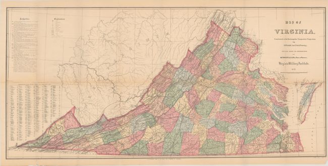
MapMaker: |
M.F. Maury
|
|
| |
| |
Subject: |
Virginia, Civil War Reconstruction |
|
| |
Period/Size: |
1871 / 16.3" x 34.8" (41.4 x 88.4 cm)
|
|
| |
Color: |
Colored
|
|
| |
Condition: |
(B+) Issued folding with light toning and numerous small fold separations along the horizontal fold that have been mostly closed on verso with archival tape. (condition help) |
|
| |
Source: |
Physical Survey of Virginia... |
|
| |
References: |
Phillips (Maps) p. 991; cf. Wooldridge (Portolan - Spring 2007) pp. 26-39; cf. Stephenson & McKee, p. 268. |
|
| |
|
|
| Sales Information |
| |
| |
Price: |
|
|
| |
| |
Offered by: |
Old World Auctions |
|
| |
Catalog: |
Auction No. 185 - Antique Maps, Charts, Atlases & Globes (9550) |
|
| |
Lot/Item #: |
340 |
|
| |
| |
Date: |
11/2021
|
|
| |
| |
|