Title:
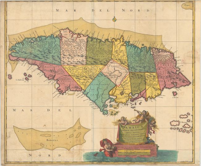
“Jamaica, Americae Septentrionalis Ampla Insula, a Christophoro Columbo Detecta, in suas Gubernationes Peraccurate Distincta”
Map Maker:
Visscher/Shenk
This large, colorful and beautifully engraved map ... (full text available to subscribers)
| Item Detail |
| |
| |
MapMaker: |
Visscher/Shenk
|
|
| |
| |
Subject: |
Jamaica |
|
| |
Period/Size: |
1720 / 20.3" x 23.5" (51.6 x 59.7 cm)
|
|
| |
Color: |
Colored
|
|
| |
Condition: |
(B) A nice impression with full contemporary color on a bright sheet with dampstains. Issued folding and trimmed at top by the bookbinder to fit in a smaller atlas, with loss of the neatline at top. (condition help) |
|
| |
Source: |
|
|
| |
References: |
Kapp (MCC-42) #27. |
|
| |
|
|
| Sales Information |
| |
| |
Price: |
|
|
| |
| |
Offered by: |
Old World Auctions |
|
| |
Catalog: |
Auction No. 185 - Antique Maps, Charts, Atlases & Globes (9550) |
|
| |
Lot/Item #: |
376 |
|
| |
| |
Date: |
11/2021
|
|
| |
| |
|
Antique Maps - Valuation and Pricing, Descriptions, Resources |
|
Home |
Information |
Search |
Register |
Contact Us |
Site Map
Americana Exchange, Inc. © 1999 - 2024 Americana Exchange, Inc.. All rights reserved.
OldMaps.com, the OldMaps.com logo and
AMPR are service marks or registered service marks of Americana Exchange, Inc..
|