Rister or Sign In to see pricing information


Title:

A Chart of the Southern Part of South America; with the Track of the Centurion from the Island of St. Catherines to the Island of Juan Fernandes...

Map Maker:

George Anson

A Chart of the Southern Part of South America; with the Track of the Centurion from the Island of St. Catherines to the Island of Juan Fernandes...

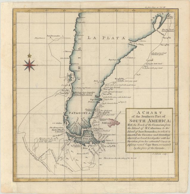
This is a reduced version of the chart showing Cap... (full text available to subscribers)
Item Detail
 
  MapMaker:  

George Anson


  Subject:  Southern South America  
  Period/Size:  1750 / 9.6" x 9.3"  (24.4 x 23.7 cm)  
  Color:  Colored  
  Condition:  (A) Issued folding, now flat, on a sheet with an "IV" watermark and minor offsetting. The sheet has been remargined at left with old paper. (condition help)  
  Source:   
  References:   
 
 
Sales Information
 
  Price: 

Please register your email to view records, or sign in with email address to see records


  Offered by:  Old World Auctions  
  Catalog:  Auction No. 185 - Antique Maps, Charts, Atlases & Globes (9550)  
  Lot/Item #:  411  
 
  Date:  11/2021  


Antique Maps - Valuation and Pricing, Descriptions, Resources


Home | Information | Search | Register | Contact Us | Site Map

Americana Exchange, Inc. © 1999 - 2024 Americana Exchange, Inc.. All rights reserved. OldMaps.com, the OldMaps.com logo and
AMPR are service marks or registered service marks of Americana Exchange, Inc..