Title:
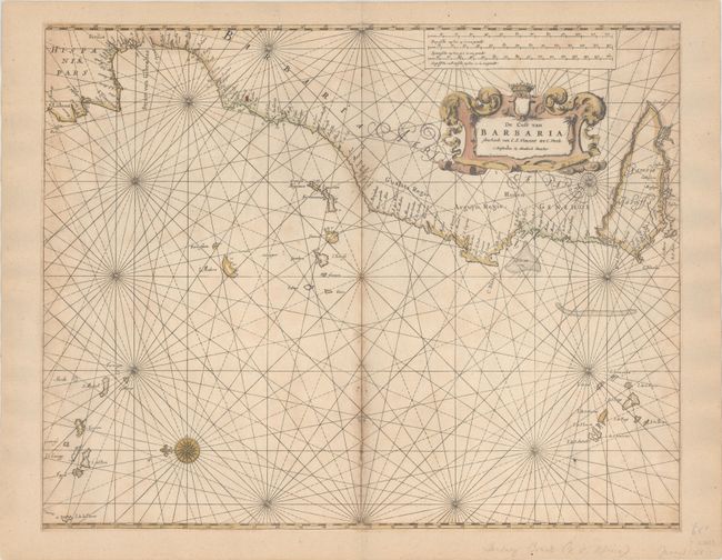
“De Cust van Barbaria Streckende van C.S. Vincent tot C. Verde”
Map Maker:
Henrick Doncker
This finely engraved sea chart covers from Lisbon,... (full text available to subscribers)
| Item Detail |
| |
| |
MapMaker: |
Henrick Doncker
|
|
| |
| |
Subject: |
Eastern Atlantic Ocean |
|
| |
Period/Size: |
1659 / 16.9" x 21.2" (43.0 x 53.9 cm)
|
|
| |
Color: |
Colored
|
|
| |
Condition: |
(B+) Trimmed to the neatline all around and entirely backed with old paper. There are several small centerfold separations and light scattered foxing mostly along the centerfold. (condition help) |
|
| |
Source: |
De Zee-Atlas ofte Water-Waerelt |
|
| |
References: |
|
|
| |
|
|
| Sales Information |
| |
| |
Price: |
|
|
| |
| |
Offered by: |
Old World Auctions |
|
| |
Catalog: |
Auction No. 185 - Antique Maps, Charts, Atlases & Globes (9550) |
|
| |
Lot/Item #: |
417 |
|
| |
| |
Date: |
11/2021
|
|
| |
| |
|
Antique Maps - Valuation and Pricing, Descriptions, Resources |
|
Home |
Information |
Search |
Register |
Contact Us |
Site Map
Americana Exchange, Inc. © 1999 - 2024 Americana Exchange, Inc.. All rights reserved.
OldMaps.com, the OldMaps.com logo and
AMPR are service marks or registered service marks of Americana Exchange, Inc..
|