Title:
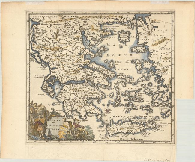
“Hellas seu Graecia Universa”
Map Maker:
Philipp Cluver
This attractive small map covers the historic regi... (full text available to subscribers)
| Item Detail |
| |
| |
MapMaker: |
Philipp Cluver
|
|
| |
| |
Subject: |
Greece |
|
| |
Period/Size: |
1697 / 9.1" x 10.2" (23.2 x 25.9 cm)
|
|
| |
Color: |
Colored
|
|
| |
Condition: |
(B+) A nice impression issued folding on watermarked paper with a binding trim at right and a 0.75" associated tear that has been closed on verso with archival tape. In the top blank margin there are remnants of hinge tape on recto and a short fold separ (condition help) |
|
| |
Source: |
Introductio in Universam Geographicam |
|
| |
References: |
Shirley (BL Atlases) T.CLUV-8a #24; Zacharakis #627. |
|
| |
|
|
| Sales Information |
| |
| |
Price: |
|
|
| |
| |
Offered by: |
Old World Auctions |
|
| |
Catalog: |
Auction No. 185 - Antique Maps, Charts, Atlases & Globes (9550) |
|
| |
Lot/Item #: |
571 |
|
| |
| |
Date: |
11/2021
|
|
| |
| |
|
Antique Maps - Valuation and Pricing, Descriptions, Resources |
|
Home |
Information |
Search |
Register |
Contact Us |
Site Map
Americana Exchange, Inc. © 1999 - 2024 Americana Exchange, Inc.. All rights reserved.
OldMaps.com, the OldMaps.com logo and
AMPR are service marks or registered service marks of Americana Exchange, Inc..
|