Title:
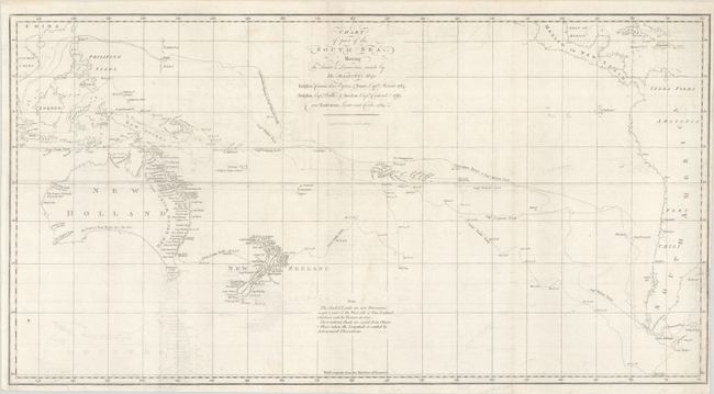
“Chart of Part of the South Sea, Shewing the Tracts & Discoveries Made by His Majestys Ships Dolphin, Commodore Byron, & Tamer, Capn Mouat, 1765 ... and Endeavour, Lieutenant Cooke, 1769”
Map Maker:
Capt. James Cook
This chart of the South Pacific covers the region ... (full text available to subscribers)
| Item Detail |
| |
| |
MapMaker: |
Capt. James Cook
|
|
| |
| |
Subject: |
South Pacific Ocean |
|
| |
Period/Size: |
1773 / 14.2" x 26.8" (36.1 x 68.1 cm)
|
|
| |
Color: |
Black & White
|
|
| |
Condition: |
(B+) A bright sheet, issued folding with light offsetting and minor soiling. There is a binding trim at right close to the neatline, with two adjacent binding tears that just enter the map border and have been closed on verso with archival tape. (condition help) |
|
| |
Source: |
Account of the Voyages Undertaken...in the Southern Hemisphere |
|
| |
References: |
Tooley (Australia) #321; Shirley (BL Atlases) G.HAWK-1a #1. |
|
| |
|
|
| Sales Information |
| |
| |
Price: |
|
|
| |
| |
Offered by: |
Old World Auctions |
|
| |
Catalog: |
Auction No. 185 - Antique Maps, Charts, Atlases & Globes (9550) |
|
| |
Lot/Item #: |
729 |
|
| |
| |
Date: |
11/2021
|
|
| |
| |
|
Antique Maps - Valuation and Pricing, Descriptions, Resources |
|
Home |
Information |
Search |
Register |
Contact Us |
Site Map
Americana Exchange, Inc. © 1999 - 2024 Americana Exchange, Inc.. All rights reserved.
OldMaps.com, the OldMaps.com logo and
AMPR are service marks or registered service marks of Americana Exchange, Inc..
|