Title:
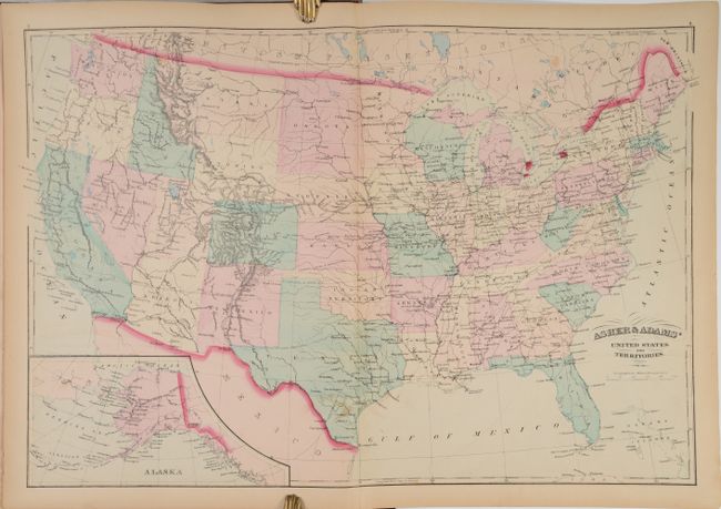
“Asher & Adams' New Commercial, Topographical, and Statistical Atlas and Gazetteer of the United States: with Maps Showing the Dominion of Canada, Europe and the World...”
Map Maker:
Asher & Adams
This large-format atlas of the United States is co... (full text available to subscribers)
| Item Detail |
| |
| |
MapMaker: |
Asher & Adams
|
|
| |
| |
Subject: |
Atlases |
|
| |
Period/Size: |
1872 / 17.9" x 13.4" (45.5 x 34.1 cm)
|
|
| |
Color: |
Colored
|
|
| |
Condition: |
(B+) The maps are very good to near fine with light toning and occasional foxing and offsetting. The map of Rhode Island has a 1.5" centerfold separation at bottom. Text is very clean and bright. Covers and spine are rubbed with a few gouges in the clo (condition help) |
|
| |
Source: |
|
|
| |
References: |
Phillips (Atlases) #1270. |
|
| |
|
|
| Sales Information |
| |
| |
Price: |
|
|
| |
| |
Offered by: |
Old World Auctions |
|
| |
Catalog: |
Auction No. 185 - Antique Maps, Charts, Atlases & Globes (9550) |
|
| |
Lot/Item #: |
773 |
|
| |
| |
Date: |
11/2021
|
|
| |
| |
|
Antique Maps - Valuation and Pricing, Descriptions, Resources |
|
Home |
Information |
Search |
Register |
Contact Us |
Site Map
Americana Exchange, Inc. © 1999 - 2024 Americana Exchange, Inc.. All rights reserved.
OldMaps.com, the OldMaps.com logo and
AMPR are service marks or registered service marks of Americana Exchange, Inc..
|