Title:
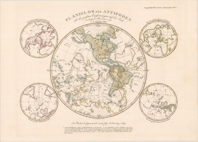
“Planiglob der Antipoden oder der Grossten Entfernungen auf der Erde nach Eigner Idee”
Map Maker:
Adolph Stieler
This fascinating and unusual map depicts the weste... (full text available to subscribers)
| Item Detail |
| |
| |
MapMaker: |
Adolph Stieler
|
|
| |
| |
Subject: |
World |
|
| |
Period/Size: |
1845 / 10.6" x 13.6" (27.0 x 34.6 cm)
|
|
| |
Color: |
Colored
|
|
| |
Condition: |
(A) Contemporary color on a bright sheet with a hint of soiling. (condition help) |
|
| |
Source: |
Stieler's Hand-Atlas |
|
| |
References: |
|
|
| |
|
|
| Sales Information |
| |
| |
Price: |
|
|
| |
| |
Offered by: |
Old World Auctions |
|
| |
Catalog: |
Auction No. 186 - Antique Maps, Charts, Atlases & Globes (9551) |
|
| |
Lot/Item #: |
32 |
|
| |
| |
Date: |
02/2022
|
|
| |
| |
|
Antique Maps - Valuation and Pricing, Descriptions, Resources |
|
Home |
Information |
Search |
Register |
Contact Us |
Site Map
Americana Exchange, Inc. © 1999 - 2024 Americana Exchange, Inc.. All rights reserved.
OldMaps.com, the OldMaps.com logo and
AMPR are service marks or registered service marks of Americana Exchange, Inc..
|