| Item Detail |
| |
| |
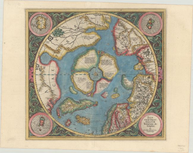
MapMaker: |
Mercator/Hondius
|
|
| |
| |
Subject: |
North Pole |
|
| |
Period/Size: |
1606 / 14.8" x 15.5" (37.6 x 39.4 cm)
|
|
| |
Color: |
Colored
|
|
| |
Condition: |
(A) A sharp, early impression on a bright, sturdy sheet with color bleed through on verso and professional repairs to a tiny hole in the image at bottom and to a tear in the bottom blank margin. (condition help) |
|
| |
Source: |
Gerardi Mercatoris - Atlas sive Cosmographicae... |
|
| |
References: |
Burden #88; Kershaw #22a; Van der Krogt (Vol. I) #0020:1A. |
|
| |
|
|
| Sales Information |
| |
| |
Price: |
|
|
| |
| |
Offered by: |
Old World Auctions |
|
| |
Catalog: |
Auction No. 186 - Antique Maps, Charts, Atlases & Globes (9551) |
|
| |
Lot/Item #: |
46 |
|
| |
| |
Date: |
02/2022
|
|
| |
| |
|