Title:
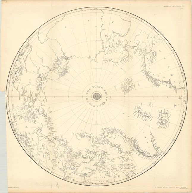
“Chart of the North Polar Sea”
Map Maker:
British Admiralty
This circumpolar map presents the Arctic explorati... (full text available to subscribers)
| Item Detail |
| |
| |
MapMaker: |
British Admiralty
|
|
| |
| |
Subject: |
North Pole |
|
| |
Period/Size: |
1850 / 24.1" x 24.3" (61.3 x 61.8 cm)
|
|
| |
Color: |
Black & White
|
|
| |
Condition: |
(B+) Issued folding and now flattened and backed with tissue. There is a small chip along a lower fold and an archivally repaired binding tear at left that just touches the border. A couple of long cracks are confined to the bottom blank margin. (condition help) |
|
| |
Source: |
|
|
| |
References: |
|
|
| |
|
|
| Sales Information |
| |
| |
Price: |
|
|
| |
| |
Offered by: |
Old World Auctions |
|
| |
Catalog: |
Auction No. 186 - Antique Maps, Charts, Atlases & Globes (9551) |
|
| |
Lot/Item #: |
51 |
|
| |
| |
Date: |
02/2022
|
|
| |
| |
|
Antique Maps - Valuation and Pricing, Descriptions, Resources |
|
Home |
Information |
Search |
Register |
Contact Us |
Site Map
Americana Exchange, Inc. © 1999 - 2024 Americana Exchange, Inc.. All rights reserved.
OldMaps.com, the OldMaps.com logo and
AMPR are service marks or registered service marks of Americana Exchange, Inc..
|