Title:
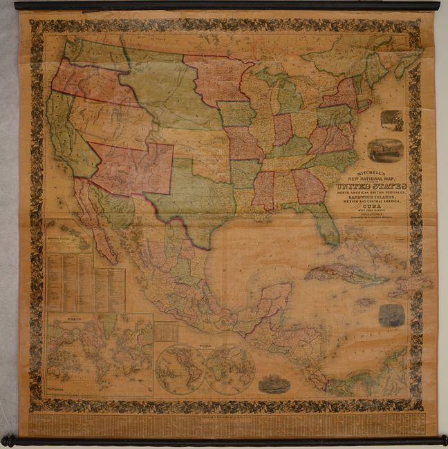
“Mitchell's New National Map, Exhibiting the United States with the North American British Provinces, Sandwich Islands, Mexico and Central America, Together with Cuba and Other West India Islands”
Map Maker:
Samuel Augustus Mitchell
This is the first edition of Mitchell's epi... (full text available to subscribers)
| Item Detail |
| |
| |
MapMaker: |
Samuel Augustus Mitchell
|
|
| |
| |
Subject: |
North America |
|
| |
Period/Size: |
1856 / 64.0" x 61.5" (162.6 x 156.3 cm)
|
|
| |
Color: |
Colored
|
|
| |
Condition: |
(B) A good example with bright contemporary color and clear varnish. As is typical for wall maps of this size, there are numerous abrasions, cracks, and small chips with some minor loss of image. There is a 4" tear in the image at top left and a 13" tea (condition help) |
|
| |
Source: |
|
|
| |
References: |
Wheat (TMW) #896; Rumsey #2292. |
|
| |
|
|
| Sales Information |
| |
| |
Price: |
|
|
| |
| |
Offered by: |
Old World Auctions |
|
| |
Catalog: |
Auction No. 186 - Antique Maps, Charts, Atlases & Globes (9551) |
|
| |
Lot/Item #: |
114 |
|
| |
| |
Date: |
02/2022
|
|
| |
| |
|
Antique Maps - Valuation and Pricing, Descriptions, Resources |
|
Home |
Information |
Search |
Register |
Contact Us |
Site Map
Americana Exchange, Inc. © 1999 - 2024 Americana Exchange, Inc.. All rights reserved.
OldMaps.com, the OldMaps.com logo and
AMPR are service marks or registered service marks of Americana Exchange, Inc..
|