Title:
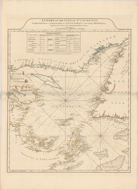
“A Chart of the Gulf of St. Laurence, Composed from a Great Number of Actual Surveys and Other Materials, Regulated and Connected by Astronomical Observations”
Map Maker:
Jefferys/Sayer & Bennett
First state of this handsome sailing chart of the ... (full text available to subscribers)
| Item Detail |
| |
| |
MapMaker: |
Jefferys/Sayer & Bennett
|
|
| |
| |
Subject: |
Gulf of St. Lawrence, Canada |
|
| |
Period/Size: |
1775 / 24.3" x 19.5" (61.8 x 49.6 cm)
|
|
| |
Color: |
Colored
|
|
| |
Condition: |
(B+) Contemporary outline color on a sturdy sheet with a Strasburg lily watermark and light offsetting. There is a grayish shadow along the centerfold that is caused by our scanner and doesn't appear on the map. (condition help) |
|
| |
Source: |
The American Atlas... |
|
| |
References: |
Kershaw #597; Phillips (Maps) p. 762. |
|
| |
|
|
| Sales Information |
| |
| |
Price: |
|
|
| |
| |
Offered by: |
Old World Auctions |
|
| |
Catalog: |
Auction No. 186 - Antique Maps, Charts, Atlases & Globes (9551) |
|
| |
Lot/Item #: |
124 |
|
| |
| |
Date: |
02/2022
|
|
| |
| |
|
Antique Maps - Valuation and Pricing, Descriptions, Resources |
|
Home |
Information |
Search |
Register |
Contact Us |
Site Map
Americana Exchange, Inc. © 1999 - 2024 Americana Exchange, Inc.. All rights reserved.
OldMaps.com, the OldMaps.com logo and
AMPR are service marks or registered service marks of Americana Exchange, Inc..
|