| Item Detail |
| |
| |
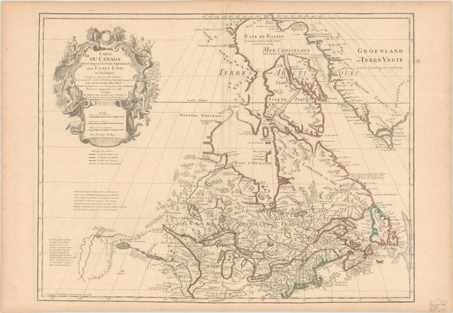
MapMaker: |
Delisle/Dezauche
|
|
| |
| |
Subject: |
Colonial Northeastern United States & Canada, Great Lakes |
|
| |
Period/Size: |
1783 / 19.7" x 25.6" (50.1 x 65.1 cm)
|
|
| |
Color: |
Colored
|
|
| |
Condition: |
(B+) A nice impression with contemporary outline color on a sturdy sheet with the watermark of a Maltese cross encircled in rosary beads. There is light toning along the centerfold and edges of the sheet, a small paper flaw in the bottom blank margin, an (condition help) |
|
| |
Source: |
Atlas Geographique... |
|
| |
References: |
Kershaw # 316; Tooley (Amer) #42, p. 21. |
|
| |
|
|
| Sales Information |
| |
| |
Price: |
|
|
| |
| |
Offered by: |
Old World Auctions |
|
| |
Catalog: |
Auction No. 186 - Antique Maps, Charts, Atlases & Globes (9551) |
|
| |
Lot/Item #: |
146 |
|
| |
| |
Date: |
02/2022
|
|
| |
| |
|