Title:
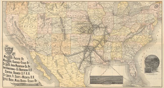
“Map of the Missouri Pacific Ry. Missouri, Kansas and Texas Ry. St. Louis, Iron Mountain and So. Ry. International and Gt. Northern R.R. ... and Connections”
Map Maker:
Railroad Companies (various)
This folding map and timetable was published for t... (full text available to subscribers)
| Item Detail |
| |
| |
MapMaker: |
Railroad Companies (various)
|
|
| |
| |
Subject: |
United States, Railroads |
|
| |
Period/Size: |
1887 / 16.8" x 31.0" (42.7 x 78.8 cm)
|
|
| |
Color: |
Colored
|
|
| |
Condition: |
(B+) Issued folding with a few small separations at the fold junctions. (condition help) |
|
| |
Source: |
|
|
| |
References: |
|
|
| |
|
|
| Sales Information |
| |
| |
Price: |
|
|
| |
| |
Offered by: |
Old World Auctions |
|
| |
Catalog: |
Auction No. 186 - Antique Maps, Charts, Atlases & Globes (9551) |
|
| |
Lot/Item #: |
159 |
|
| |
| |
Date: |
02/2022
|
|
| |
| |
|
Antique Maps - Valuation and Pricing, Descriptions, Resources |
|
Home |
Information |
Search |
Register |
Contact Us |
Site Map
Americana Exchange, Inc. © 1999 - 2024 Americana Exchange, Inc.. All rights reserved.
OldMaps.com, the OldMaps.com logo and
AMPR are service marks or registered service marks of Americana Exchange, Inc..
|