| Item Detail |
| |
| |
MapMaker: |
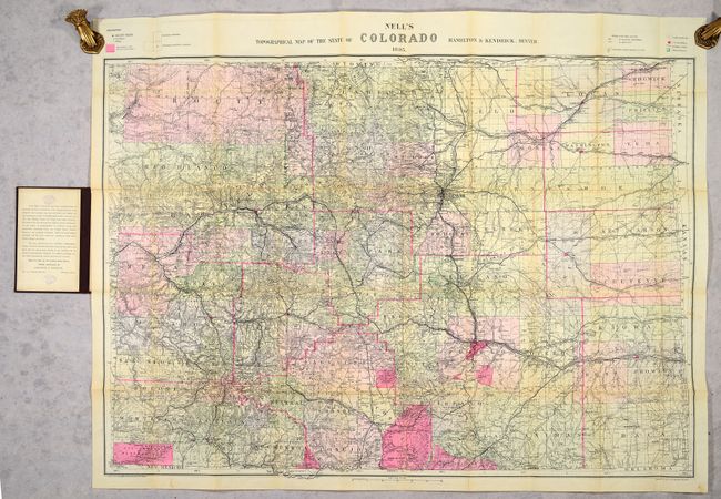
Louis Nell
|
|
| |
| |
Subject: |
Colorado |
|
| |
Period/Size: |
1895 / 29.0" x 39.7" (73.7 x 100.9 cm)
|
|
| |
Color: |
Colored
|
|
| |
Condition: |
(B+) Issued folding on a clean sheet with expert repairs to a long fold separation with some minor image loss at a couple of fold junctions. There are stamps from a previous owner on verso and on the pastedown of the front cover. Covers have minor wear. (condition help) |
|
| |
Source: |
|
|
| |
References: |
|
|
| |
|
|
| Sales Information |
| |
| |
Price: |
|
|
| |
| |
Offered by: |
Old World Auctions |
|
| |
Catalog: |
Auction No. 186 - Antique Maps, Charts, Atlases & Globes (9551) |
|
| |
Lot/Item #: |
253 |
|
| |
| |
Date: |
02/2022
|
|
| |
| |
|