Title:
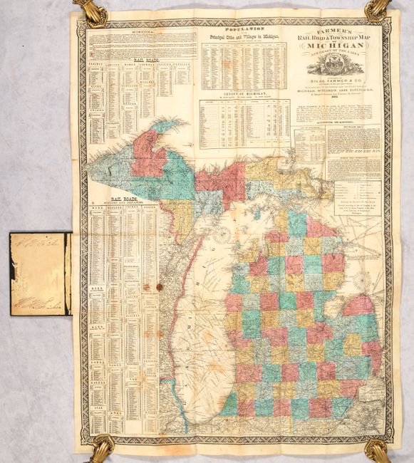
“Farmer’s Rail Road & Township Map of Michigan and Chart of the Lakes”
Map Maker:
Silas Farmer & Co.
This highly detailed map is delineated by county a... (full text available to subscribers)
| Item Detail |
| |
| |
MapMaker: |
Silas Farmer & Co.
|
|
| |
| |
Subject: |
Michigan |
|
| |
Period/Size: |
1873 / 30.4" x 23.2" (77.3 x 59.0 cm)
|
|
| |
Color: |
Colored
|
|
| |
Condition: |
(B) Issued folding with some staining primarily at left and several short splits at the fold junctions that have been mostly closed on verso with archival tape. Covers have light wear with the rear board warped. (condition help) |
|
| |
Source: |
|
|
| |
References: |
|
|
| |
|
|
| Sales Information |
| |
| |
Price: |
|
|
| |
| |
Offered by: |
Old World Auctions |
|
| |
Catalog: |
Auction No. 186 - Antique Maps, Charts, Atlases & Globes (9551) |
|
| |
Lot/Item #: |
279 |
|
| |
| |
Date: |
02/2022
|
|
| |
| |
|
Antique Maps - Valuation and Pricing, Descriptions, Resources |
|
Home |
Information |
Search |
Register |
Contact Us |
Site Map
Americana Exchange, Inc. © 1999 - 2024 Americana Exchange, Inc.. All rights reserved.
OldMaps.com, the OldMaps.com logo and
AMPR are service marks or registered service marks of Americana Exchange, Inc..
|