| Item Detail |
| |
| |
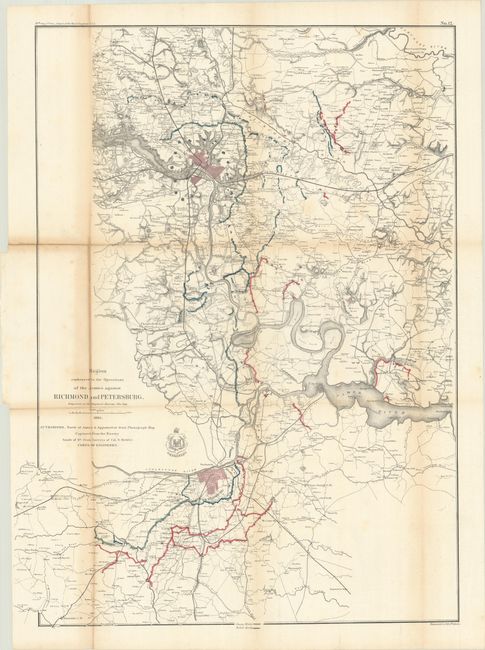
MapMaker: |
U.S. War Department
|
|
| |
| |
Subject: |
Central Virginia, Civil War |
|
| |
Period/Size: |
1865 / 32.6" x 24.1" (82.8 x 61.3 cm)
|
|
| |
Color: |
Colored
|
|
| |
Condition: |
(B) Issued folding and now flattened and backed with tissue to reinforce and repair a few small fold separations. There is light toning along the folds which is more prominent at left along with some minor staining. (condition help) |
|
| |
Source: |
Report of Chief Engineer U.S.A., 39th Congress, 1st Session |
|
| |
References: |
Stephenson (Civil War) #644. |
|
| |
|
|
| Sales Information |
| |
| |
Price: |
|
|
| |
| |
Offered by: |
Old World Auctions |
|
| |
Catalog: |
Auction No. 186 - Antique Maps, Charts, Atlases & Globes (9551) |
|
| |
Lot/Item #: |
333 |
|
| |
| |
Date: |
02/2022
|
|
| |
| |
|