| Item Detail |
| |
| |
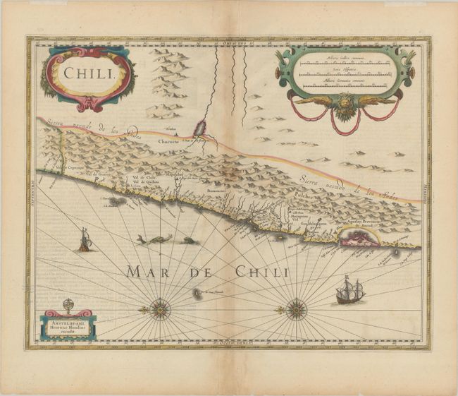
MapMaker: |
Henricus Hondius
|
|
| |
| |
Subject: |
Chile |
|
| |
Period/Size: |
1636 / 14.7" x 19.0" (37.4 x 48.3 cm)
|
|
| |
Color: |
Colored
|
|
| |
Condition: |
(B+) Nice impression in contemporary color on paper with a large "V" watermark, light toning along the centerfold, and light text show-through. The top blank margin has remnants of hinge tape. There is a tiny separation at bottom centerfold and a few ti (condition help) |
|
| |
Source: |
Atlas or a Geographicke Description of the Regions, Countries and Kingdoms of th |
|
| |
References: |
Van der Krogt (Vol. I) #9920:1.1. |
|
| |
|
|
| Sales Information |
| |
| |
Price: |
|
|
| |
| |
Offered by: |
Old World Auctions |
|
| |
Catalog: |
Auction No. 186 - Antique Maps, Charts, Atlases & Globes (9551) |
|
| |
Lot/Item #: |
389 |
|
| |
| |
Date: |
02/2022
|
|
| |
| |
|