Title:
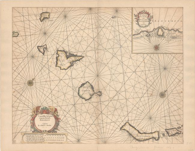
“Canarische Eylanden Canaria, Tenerisa, Forteventura Etc.”
Map Maker:
Henrick Doncker
This attractive sea chart depicts the Canary Islan... (full text available to subscribers)
| Item Detail |
| |
| |
MapMaker: |
Henrick Doncker
|
|
| |
| |
Subject: |
Canary Islands |
|
| |
Period/Size: |
1659 / 16.8" x 21.0" (42.7 x 53.4 cm)
|
|
| |
Color: |
Colored
|
|
| |
Condition: |
(B) Trimmed to the neatline all around and entirely backed with old paper. There is a narrow, 3" abrasion to the right of the centerfold with a minor amount of rhumb lines drawn in facsimile and light scattered foxing. (condition help) |
|
| |
Source: |
De Zee-Atlas ofte Water-Waerelt |
|
| |
References: |
|
|
| |
|
|
| Sales Information |
| |
| |
Price: |
|
|
| |
| |
Offered by: |
Old World Auctions |
|
| |
Catalog: |
Auction No. 186 - Antique Maps, Charts, Atlases & Globes (9551) |
|
| |
Lot/Item #: |
394 |
|
| |
| |
Date: |
02/2022
|
|
| |
| |
|
Antique Maps - Valuation and Pricing, Descriptions, Resources |
|
Home |
Information |
Search |
Register |
Contact Us |
Site Map
Americana Exchange, Inc. © 1999 - 2024 Americana Exchange, Inc.. All rights reserved.
OldMaps.com, the OldMaps.com logo and
AMPR are service marks or registered service marks of Americana Exchange, Inc..
|