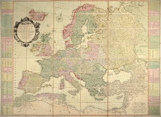
Title:
“Bowles's New Four-Sheet Map of Europe, Divided into Its Empires, Kingdoms, States, Republicks and Principalities...”
Map Maker:
Bowles & Carver
This wall-sized map of Europe was printed on four ... (full text available to subscribers)
| Item Detail |
| |
| |
MapMaker: |
Bowles & Carver
|
|
| |
| |
Subject: |
Europe |
|
| |
Period/Size: |
1795 / 40.4" x 48.3" (102.7 x 122.7 cm)
|
|
| |
Color: |
Colored
|
|
| |
Condition: |
(B+) Full contemporary color with light soiling and a small stain in the North Sea. The slipcase is well worn with separations along the bottom edge, but is still intact. (condition help) |
|
| |
Source: |
|
|
| |
References: |
|
|
| |
|
|
| Sales Information |
| |
| |
Price: |
|
|
| |
| |
Offered by: |
Old World Auctions |
|
| |
Catalog: |
Auction No. 186 - Antique Maps, Charts, Atlases & Globes (9551) |
|
| |
Lot/Item #: |
409 |
|
| |
| |
Date: |
02/2022
|
|
| |
| |
|
Antique Maps - Valuation and Pricing, Descriptions, Resources |
|
Home |
Information |
Search |
Register |
Contact Us |
Site Map
Americana Exchange, Inc. © 1999 - 2024 Americana Exchange, Inc.. All rights reserved.
OldMaps.com, the OldMaps.com logo and
AMPR are service marks or registered service marks of Americana Exchange, Inc..
|