Title:
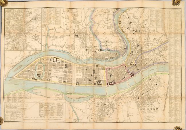
“Plan de la Ville de Lyon et de Ses Environs”
Map Maker:
Jean Baptiste Pierre Tardieu
An attractive plan of the city of Lyon, situated a... (full text available to subscribers)
| Item Detail |
| |
| |
MapMaker: |
Jean Baptiste Pierre Tardieu
|
|
| |
| |
Subject: |
Lyon, France |
|
| |
Period/Size: |
1850 / 21.9" x 34.5" (55.7 x 87.7 cm)
|
|
| |
Color: |
Colored
|
|
| |
Condition: |
(B+) There is light scattered foxing and a few fold separations that have been closed on verso with archival materials. Covers have light wear with bumped corners. (condition help) |
|
| |
Source: |
|
|
| |
References: |
|
|
| |
|
|
| Sales Information |
| |
| |
Price: |
|
|
| |
| |
Offered by: |
Old World Auctions |
|
| |
Catalog: |
Auction No. 186 - Antique Maps, Charts, Atlases & Globes (9551) |
|
| |
Lot/Item #: |
470 |
|
| |
| |
Date: |
02/2022
|
|
| |
| |
|
Antique Maps - Valuation and Pricing, Descriptions, Resources |
|
Home |
Information |
Search |
Register |
Contact Us |
Site Map
Americana Exchange, Inc. © 1999 - 2024 Americana Exchange, Inc.. All rights reserved.
OldMaps.com, the OldMaps.com logo and
AMPR are service marks or registered service marks of Americana Exchange, Inc..
|